Palmas, Las · Canarias
San Bartolomé de Tirajana
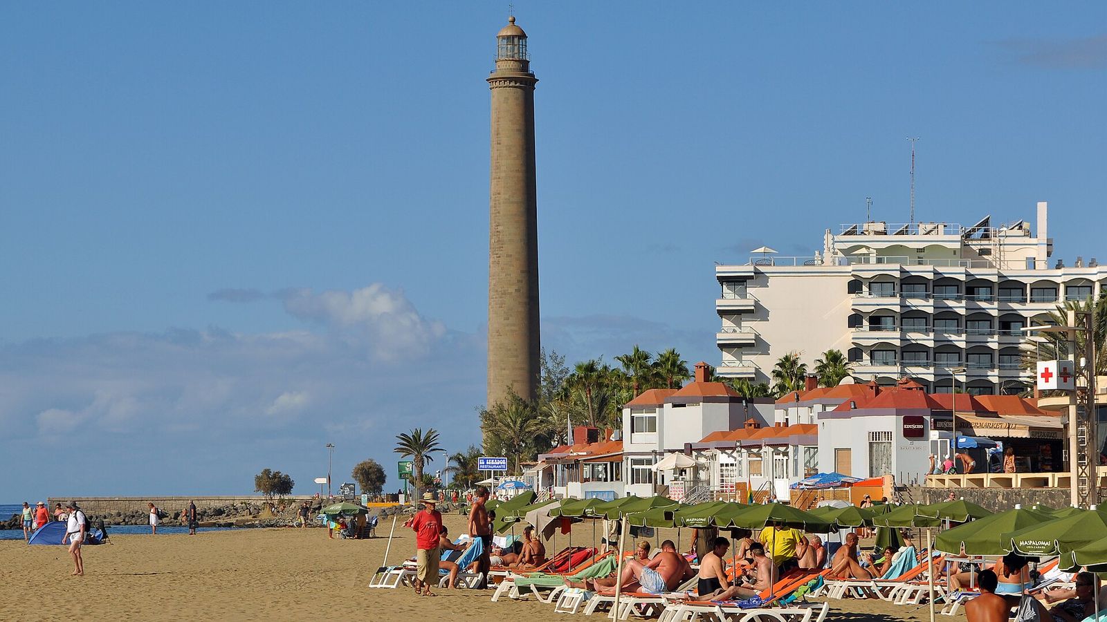
A vast Gran Canaria municipality that runs from the mountainous interior down to the island's biggest tourist centres on the southern coast — Maspalomas, Playa del Inglés and San Agustín — built almost entirely for leisure.
.jpg)
The case for San Bartolomé de Tirajana
- only 10 rainy days a year
- 19.4°C average winters
- summer highs of just 26.2°C
- LPA airport 40 minutes away
- Telde — a 100,000+ city — 48 minutes by road
- 387 restaurants and cafés
- 28 schools in town
- 10.1% of residents are under 15 — more children than the typical Spanish town
- 90% fibre-to-the-home coverage
No adjectives, no opinions — every line is a measured value from the data below, shown only when San Bartolomé de Tirajana genuinely earns it. Distances marked "as the crow flies" are straight-line estimates.
San Bartolomé de Tirajana's Spainability Scores — by who's moving
Not our opinion: we ran the same scoring engine behind the quiz for six settler profiles across all 8,132 municipalities. Each score is San Bartolomé de Tirajana's percentile for that group — 87 means it beats 87% of the towns we could score. How scoring works.
Higher than 98% of the 8,088 Spanish municipalities we could score for retiring couples.
A vast Gran Canaria municipality that runs from the mountainous interior down to the island's biggest tourist centres on the southern coast — Maspalomas, Playa del Inglés and San Agustín — built almost entirely for leisure. A strong pick for a retiring couple — a hospital in town and a health centre close by.
- Winter average temp 19.4°C
- Drive to a hospital 0 min
- Surgical wait (region) 106 days
- Registered long-let rent €8.93/m²·mo
Higher than 92% of the 8,088 Spanish municipalities we could score for American retirees.
A vast Gran Canaria municipality that runs from the mountainous interior down to the island's biggest tourist centres on the southern coast — Maspalomas, Playa del Inglés and San Agustín — built almost entirely for leisure. A strong pick for American retirees — a hospital in town and a health centre close by.
- Winter average temp 19.4°C
- Drive to a hospital 0 min
- U.S.-born residents 0.78 per 1,000
- Registered long-let rent €8.93/m²·mo
Higher than 78% of the 2,555 Spanish municipalities we could score for heat-averse settlers.
A vast Gran Canaria municipality that runs from the mountainous interior down to the island's biggest tourist centres on the southern coast — Maspalomas, Playa del Inglés and San Agustín — built almost entirely for leisure. A strong pick if you can't stand hot summers — 4 km from the sea and a settled international community.
- Summer high (Jul–Aug) 26.2°C
- Rainy days a year 10 days
- Winter average temp 19.4°C
Not scored for families — excluded by this tight-budget profile's affordability gate: the registered rent here (€8.93/m²·mo) is in the priciest 10% nationally.
A vast Gran Canaria municipality that runs from the mountainous interior down to the island's biggest tourist centres on the southern coast — Maspalomas, Playa del Inglés and San Agustín — built almost entirely for leisure. Worth a look for a family with school-age kids.
- Schools in town 28
- PISA maths (region) 447
- Registered long-let rent €8.93/m²·mo
- Drive to a hospital 0 min
Not scored for remote workers — excluded by this tight-budget profile's affordability gate: the registered rent here (€8.93/m²·mo) is in the priciest 10% nationally.
A vast Gran Canaria municipality that runs from the mountainous interior down to the island's biggest tourist centres on the southern coast — Maspalomas, Playa del Inglés and San Agustín — built almost entirely for leisure. Worth a look for a remote-working couple.
- 100 Mbps+ coverage 91%
- Drive to nearest airport 40 min
- Registered long-let rent €8.93/m²·mo
- Summer high (Jul–Aug) 26.2°C
Not scored for budget-first coastal settlers — excluded by this tight-budget profile's affordability gate: the registered rent here (€8.93/m²·mo) is in the priciest 10% nationally.
A vast Gran Canaria municipality that runs from the mountainous interior down to the island's biggest tourist centres on the southern coast — Maspalomas, Playa del Inglés and San Agustín — built almost entirely for leisure. Worth a look for coastal living on a budget.
- Registered long-let rent €8.93/m²·mo
- Net income per person €13,866
- Summer high (Jul–Aug) 26.2°C
What is the climate like in San Bartolomé de Tirajana?
San Bartolomé de Tirajana's reported winter average is 19.4°C, while July–August highs reach 26.2°C.
Climate
- Winter average temp
- 19.4°C top 1% of 8,131 towns 11.6°C above the Spanish average (7.8°C)
- Summer high (Jul–Aug)
- 26.2°C top 11% of 8,131 towns 4°C below the Spanish average (30.2°C)
- Rainy days a year
- 10 days top 1% of 8,088 towns 85% less than the Spanish average (69 days)
- Sunshine
- no local data
- Summer water stress (WEI+)
- no local data
- River-flood depth (T=100, town centre) estimated
- 0 m top 1% of 8,129 towns 0.04 m below the Spanish average (0.04 m)
- River-flood risk score estimated
- 0 top 1% of 8,129 towns about the Spanish average (0)
- Wildfire burn rate (2010–23)
- 0.15 ha/km² bottom 40% of 8,132 towns 2.16 ha/km² below the Spanish average (2.31 ha/km²)
- Forest fires (2010–23)
- 8 bottom 14% of 8,132 towns 2 above the Spanish average (6)
- High fire-weather days (province) regional estimate
- 27.6% bottom 8% of 8,130 towns 4.7% above the Spanish average (22.9%)
The year, month by month
AEMET 30-year climate normals — what a January or an August actually feels like, not the annual average.
How good is healthcare in San Bartolomé de Tirajana?
San Bartolomé de Tirajana's nearest health centre is 8.3 km away, and the reported hospital drive is 0 min.
Healthcare
- Drive to a hospital
- 0 min top 1% of 8,132 towns
- Nearest health centre
- 8.3 km top 48% of 8,132 towns
- Surgical wait (region) regional estimate
- 106 days #12 of 17 regions, +3 days vs national about the Spanish average (108 days)
What are schools like in San Bartolomé de Tirajana?
San Bartolomé de Tirajana has 28 schools in town; the nearest international school is 9 km away.
Schools
- Schools in town
- 28 top 2% of 7,042 towns
- Nearest international school
- 9 km top 7% of 8,132 towns
- PISA maths (region) regional estimate
- 447 #17 of 17 regions, −32 vs national 34 below the Spanish average (481)
How much does it cost to live in San Bartolomé de Tirajana?
San Bartolomé de Tirajana's reported home price is €3,139/m², while registered long-let rent is €8.93/m²·mo.
Cost & economy
- Home price
- €3,139/m² appraisal (valor tasado) bottom 15% of 306 towns 42% more than the Spanish average (€2,208/m²)
- Asking price
- no local data
- Registered long-let rent
- €8.93/m²·mo
- Registered rent p25
- €6.94/m²·mo
- Registered rent p75
- €12/m²·mo
- Registered-rent yield
- 3.41% bottom 14% of 306 towns
- Net income per person
- €13,866 bottom 43% of 8,059 towns 4% less than the Spanish average (€14,495)
- Income growth ’18–’23
- 28.2% top 36% of 6,605 towns
Which languages are used in schools in San Bartolomé de Tirajana?
Spanish is the only region-wide official language in the Canary Islands, and Spanish-medium teaching is the public-school default. Individual bilingual and international programmes can use other languages, so check the specific school. See the the Canary Islands region guide for the wider regional context.
What is the community like in San Bartolomé de Tirajana?
San Bartolomé de Tirajana's reported population is 54,925.
Who lives here
- Population
- 54,925
- Born in Spain
- 65% 23.8% below the Spanish average (88.8%)
- Born elsewhere in EU/UK
- 18.2% 14.3% above the Spanish average (3.8%)
- U.S.-born residents
- 0.78 per 1,000
How easy is it to get around San Bartolomé de Tirajana?
San Bartolomé de Tirajana is a reported 40 min drive from the nearest airport, with 90% fibre-to-home coverage.
Getting around
- Drive to nearest airport
- 40 min top 14% of 8,132 towns
- Fibre-to-home coverage
- 90% top 49% of 8,132 towns 11% above the Spanish average (79%)
- 100 Mbps+ coverage
- 91% bottom 41% of 8,132 towns 7% above the Spanish average (83%)
Numbers: Spainability town dataset, derived from INE, AEMET, Mitma and the Catastro. Registered long-let rent is SERPAVI declared-contract data; its p25–p75 values show the observed band. Registered-rent yield is gross, excludes costs and is never imputed. Percentile chips count only the municipalities that report the figure — the "of n" says how many. Region-ranked figures (PISA, surgical waits) compare Spain's 17 comunidades autónomas. A blank means no municipal-level figure is published — not a zero.
How does San Bartolomé de Tirajana fit you?
These are the town's numbers. Whether it's your town depends on what you're optimising for — winter sun or mild summers, a city or a village, short medical waits, an easy flight home. The 3-minute quiz scores San Bartolomé de Tirajana against every one of Spain's 8,132 municipalities on your priorities. It sits about 38 min from Santa Lucía de Tirajana, if that's your anchor.
Take the quiz — rank San Bartolomé de Tirajana for you →Questions to verify locally
- Ask whether current long-let rents match the registered-contract figure.
- Request recent comparable sales before relying on the appraisal figure.
- Test fibre speed at the exact address, not the town average.
- Visit local schools and confirm places for incoming families.
- Confirm health-centre registration and opening hours in person.
- Ask about summer rental crowds and parking near the coast.
Nearby towns
Other places we profile within easy reach.